


World Map Journal — Van Schagen 1689 Nova Totius Terrarum Orbis Dutch Golden Age
World Map Journal — Van Schagen 1689 Nova Totius Terrarum Orbis Dutch Golden Age
Couldn't load pickup availability
🚚 Add 2 items → Free shipping to USA
🌍 Add 4 items → Free shipping Worldwide
Shipping & Returns
Shipping & Returns
• Production Time: All journals are printed on demand and shipped from Maryland, USA, within 1–3 business days.
• Estimated Delivery: 3–5 business days for the US, 7–12 business days for Europe, and 10–20 business days for the rest of the world.
• Free Shipping: Enjoy free shipping to the US on orders of 2+ items, and worldwide on orders of 4+ items! (Standard shipping starts at $5.29 for the US and $13.99 worldwide).
• Damages & Returns: As each item is made to order, we do not accept returns for change of mind. However, if your order arrives damaged or incorrect, please contact us within 14 days at hello@lebonjournal.com and we will resolve it immediately.
In 1689, Amsterdam cartographer Gerard van Schagen engraved the Nova Totius Terrarum Orbis Tabula — a double-hemisphere world map bordered by Romeyn de Hooghe’s allegorical panels of Roman gods, mythological sea creatures, and dramatic battle scenes, where California still appears as an island and the oceans teem with monsters; later censored from Dutch Staten Bible editions, this original plate survives as one of the rarer documents of the Dutch Golden Age of cartography, reproduced in full across both covers of this journal.
Product Details
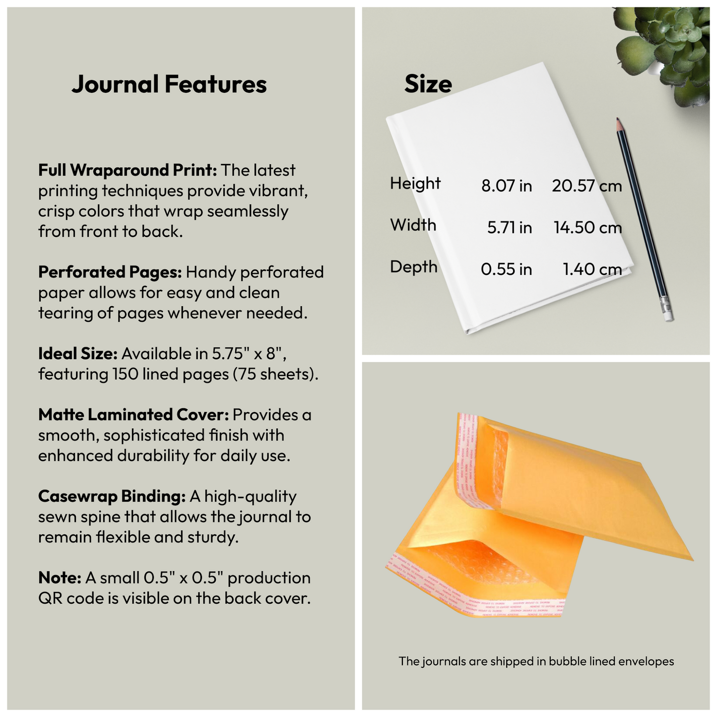
- Format: Hardcover journal with matte laminated full-wrap cover
- Pages: 150 lined pages (75 sheets) with perforations for easy removal
- Binding: Casewrap sewn binding — flexible and lay-flat
- Dimensions: 5.75 × 8 inches
- Weight: 250 g (0.55 lbs)
- Cover: Matte laminated full-wrap print
- Note: small production barcode (0.5" × 0.5") on back cover
Perfect For
- Cartography enthusiasts, map collectors, and geography lovers
- Travellers and explorers documenting journeys around the world
- Dutch Golden Age history and art admirers
- Gift for anyone captivated by antique maps, maritime history, and Baroque allegorical art
- Students and educators of 17th-century cartography and exploration history
- Collectors of rare historical documents and Dutch East India Company era artefacts
EU Compliance
EU Compliance
Representative: HONSON VENTURES LIMITED, gpsr@honsonventures.com, 3 Gnaftis House flat 102, Limassol, Mesa Geitonia, 4003, CY.
Product information: Generic brand, 2-year warranty in EU and Northern Ireland as per Directive 1999/44/EC.
Care instructions: Use a soft, clean and dry cloth to gently brush any dust or dirt off from the center of book outwards.
Share


The item arrived on time and in great condition