Reading the Earth: Vuillemin, Emslie, and the Victorian Invention of Deep Time
I. The Scandal of Deep Time
In 1788, the Scottish geologist James Hutton stood at Siccar Point on the coast of Berwickshire and looked at a rock face that would change the way humanity understood its place in the universe. Two layers of stone met at a dramatic angle — nearly vertical grey greywacke below, nearly horizontal red sandstone above. Between them, an unconformity: a gap in the geological record representing not thousands but millions of years of erosion, deposition, and tectonic movement.
Hutton’s companion, the mathematician John Playfair, later wrote that “the mind seemed to grow giddy by looking so far into the abyss of time.” It was not a metaphor. The discovery of deep time — the recognition that the Earth was not thousands but hundreds of millions of years old — was one of the most disorienting intellectual events in human history. It required not only a new science but a new visual language: a way of representing time so vast that no human mind could hold it directly.
That visual language was invented, refined, and popularized in the nineteenth century. Its most powerful expressions were the geological cross-section and the stratigraphic column — diagrams that compressed millions of years into a single image, making deep time legible to anyone who could read a picture.
II. The Science of Layers
The foundational principle of stratigraphy — the science of rock layers — is deceptively simple: in any undisturbed sequence of sedimentary rocks, the oldest layers are at the bottom and the youngest at the top. This principle of superposition, formalized by the Danish geologist Nicolas Steno in the seventeenth century, gave geologists a way to read the rock record as a sequence of events ordered in time.
What Hutton added, in his Theory of the Earth (1788), was the recognition that this sequence had no visible beginning and no foreseeable end — that the processes shaping the Earth’s surface (erosion, deposition, uplift, subsidence) were continuous, cyclical, and immeasurably slow. “We find no vestige of a beginning,” he wrote, “no prospect of an end.” The Earth was not a creation but a process.
William Smith, the English canal surveyor who produced the first geological map of Britain in 1815, demonstrated that rock layers could be identified and correlated across vast distances by the fossils they contained. Geology became, for the first time, a science capable of mapping not just the surface of the Earth but its history.
Charles Lyell’s Principles of Geology (1830–1833) synthesized these discoveries into a coherent framework — uniformitarianism, the doctrine that the same processes operating today had operated throughout geological history — and made them accessible to the educated general reader. It was the book that Charles Darwin took on the Beagle, and that shaped his thinking about the slow, cumulative processes of natural selection.
III. Alexandre Vuillemin and the French Tradition
Alexandre Vuillemin (1812–1880) was a French cartographer and scientific illustrator whose work spanned geography, geology, and natural history. Trained in the tradition of French scientific illustration — precise, systematic, and designed for didactic use — he produced diagrams that were as much pedagogical instruments as scientific records.
His Coupe Idéale de la Croûte Terrestre — the ideal cross-section of the Earth’s crust — is a vertical journey through geological time. From the incandescent liquid core at the base, through the Primitive granites and gneisses, upward through the great sedimentary epochs — Carboniferous, Jurassic, Cretaceous, Tertiary — to the Diluvium and recent deposits at the surface, the diagram organizes planetary history into a single legible image.
What makes Vuillemin’s cross-section distinctive is its dynamism. Red volcanic columns pierce every layer from base to surface, connecting the molten interior to the volcans actuels at the top — a visual argument that the Earth is not a static archive but a living system, perpetually renewed by subterranean energy. The chronological table at the left margin provides the temporal framework; the cross-section itself provides the spatial one. Together, they offer two ways of reading the same deep history.
The diagram was produced for French educational use — for the lycées and grandes écoles where geology was taught as part of the natural sciences curriculum — and it reflects the French republican conviction that scientific knowledge should be organized, systematized, and made available to all educated citizens.
IV. John Emslie, James Reynolds, and the British Tradition
John Emslie was a London-based scientific illustrator who worked primarily for the publisher James Reynolds in the mid-nineteenth century. Reynolds specialized in popular scientific diagrams — large, colorful, and designed for display and instruction — that brought the findings of Victorian science to a broad public audience.
Emslie’s Section of the Earth’s Crust (c.1850), reviewed by the geologist John Morris, divides the Earth’s crust into three great rock families: the massive unstratified metamorphic granite at the base, in rose; the tilted stratified metamorphic rocks — gneiss, mica schist, clay slate — at the lower right; and the numbered horizontal sedimentary deposits rising from ancient Cambrian and Silurian systems through the Carboniferous coal layer, Lias, Oolite, Wealden, and the distinctive Chalk horizon, to Tertiary and Alluvium at the surface.
Dark green trap and red porphyry dykes cut vertically through the sediments — magma’s signature written in stone, the same volcanic intrusions that appear in Vuillemin’s diagram, rendered in a different visual language but expressing the same geological truth.
Where Vuillemin organized, Emslie dramatized. Where the French diagram offered a complete theoretical framework, the British diagram offered a vivid encounter with the strangeness of geological reality — the improbable colors of the rock sequence, the violence of the intrusions, the sheer improbability of the Chalk horizon, a layer of compressed marine organisms hundreds of meters thick, deposited at the bottom of a warm shallow sea that covered what is now southern England.
V. Two Traditions, One Planet
Vuillemin and Emslie were working in different national traditions, for different audiences, with different visual conventions. But they were addressing the same problem: how to make deep time visible. How to compress hundreds of millions of years into an image that a student, a teacher, or a curious reader could hold in their hands and understand.
The solutions they found were complementary. Vuillemin’s diagram is a theoretical model — an ideal cross-section that shows how the Earth’s crust is organized in principle. Emslie’s diagram is a descriptive record — a cross-section of actual rock types, classified and numbered, with the visual drama of the intrusions providing the emotional impact.
Together, they represent the two poles of Victorian geological illustration: the systematic and the dramatic, the French and the British, the theoretical and the empirical. They are, in this sense, a dialogue — two ways of reading the same planet, two ways of making the same deep history legible.
VI. The Legacy of the Cross-Section
The geological cross-section remains, nearly two centuries after Vuillemin and Emslie, the primary visual tool of the geologist. Every geological survey, every mining report, every environmental impact assessment includes cross-sections that descend directly from the Victorian tradition — the same conventions of color, the same numbered layers, the same vertical exaggeration that makes the structure of the crust legible at a glance.
What has changed is the data behind the diagrams. Seismic surveys, borehole records, and satellite imagery have given geologists a picture of the Earth’s interior that Hutton and Lyell could not have imagined. But the visual language through which that picture is communicated — the cross-section, the stratigraphic column, the color-coded rock sequence — is the language that Vuillemin and Emslie helped to invent.
To look at their diagrams today is to see the beginning of a visual tradition that is still alive — still being used, still being refined, still making the invisible interior of the Earth legible to those who need to understand it.
VII. A Note on This Journal

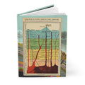
The covers of this journal carry Vuillemin’s and Emslie’s cross-sections of the Earth’s crust — two Victorian attempts to make deep time visible, in the French and British scientific traditions. For geologists, earth scientists, and anyone who reads landscapes like books.
👉 Geology Journal — Vuillemin & Emslie c.1850
References
- Hutton, J. (1788). Theory of the Earth. Transactions of the Royal Society of Edinburgh.
- Lyell, C. (1830–1833). Principles of Geology. John Murray, London.
- Smith, W. (1815). A Delineation of the Strata of England and Wales. London.
- Rudwick, M.J.S. (1976). The Meaning of Fossils. University of Chicago Press.
- Rudwick, M.J.S. (2005). Bursting the Limits of Time. University of Chicago Press.
- Winchester, S. (2001). The Map That Changed the World. HarperCollins.
- Secord, J.A. (2000). Victorian Sensation. University of Chicago Press.